
Castalia Institute · Lunar Proving Grounds
Lunar Proving
Grounds
Autonomous rover operations on lunar-analog terrain—regolith navigation, environmental sensing, and mission autonomy tested in the high desert of the San Luis Valley.
Autonomous rover operations on lunar-analog terrain—regolith navigation, environmental sensing, and mission autonomy tested in the high desert of the San Luis Valley.
The Autonomous Field Rover (AFR) is designed to operate reliably in dust, wind, temperature swings, and remote locations—conditions typical of the San Luis Valley and similar high-desert environments.
GPS waypoint following, SLAM-based mapping, and obstacle avoidance across unstructured terrain.
Temperature, humidity, barometric pressure, VOC, and soil moisture data collection.
Stereo vision and LiDAR-based 3D terrain reconstruction for geological survey.
LiFePO4 batteries with optional solar charging for 4–10 hour autonomous missions.
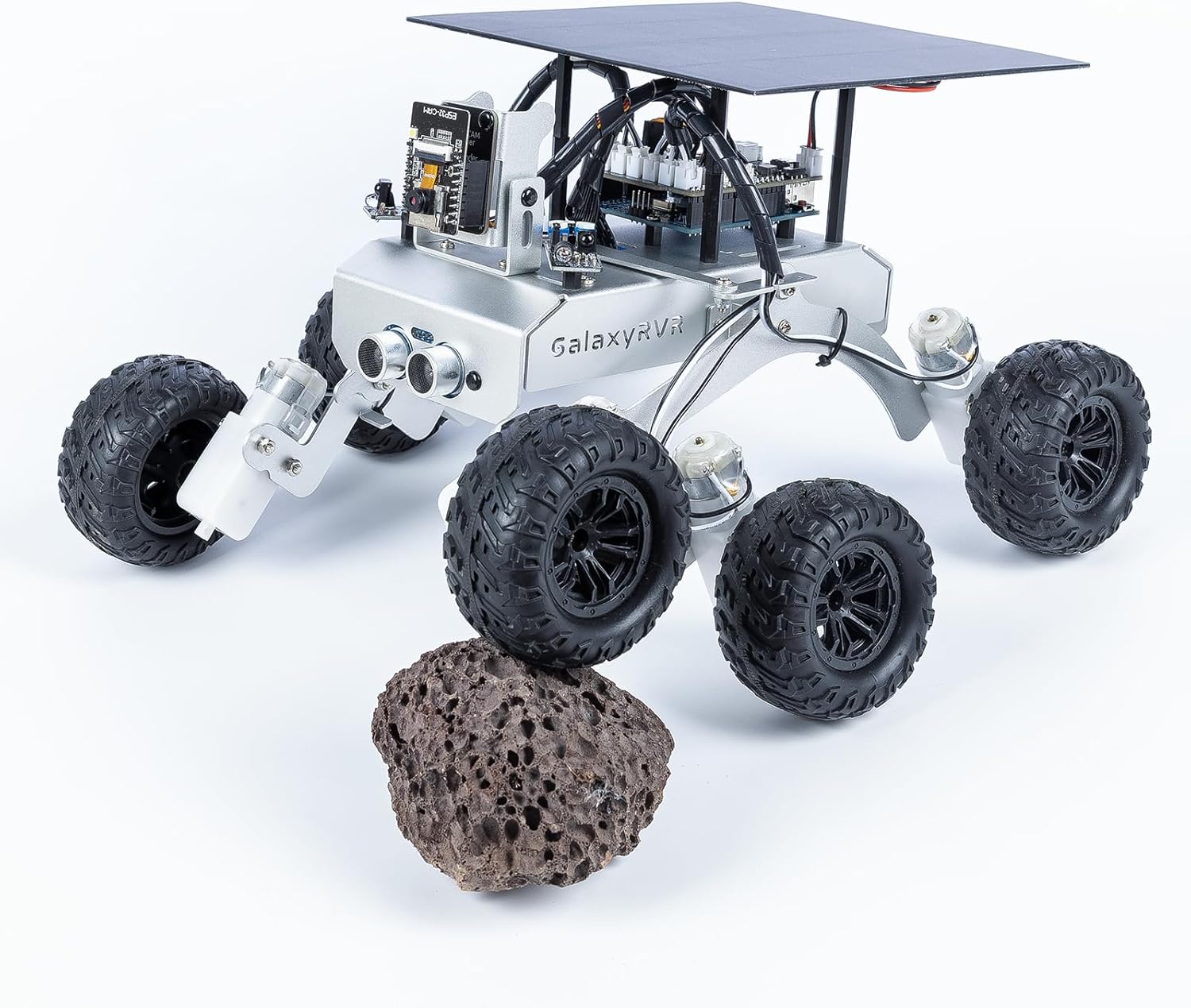
The GalaxyRVR Mars Rover Kit serves as a prototyping reference—a rocker-bogie suspension system, ESP32 camera, solar charging, and Arduino-based control in a compact, terrain-ready package.
Multi-band RTK-capable receiver delivering ~2 cm positional accuracy for precise waypoint navigation and geo-referenced data collection.
Bosch BNO085 or ICM-20948 for orientation and dead reckoning between GPS fixes.
OAK-D or ZED Mini for real-time depth mapping and obstacle detection.
Sony IMX sensor with M12 lens for terrain classification and navigation AI.
Temperature, humidity, barometric pressure, and VOC gas sensing in a single module.
Wi-Fi (100–300 m primary), LoRa or LTE for long-range, optional Starlink base station. Telemetry includes GPS, battery, speed, sensor data, and system health.
Direct teleoperation via Wi-Fi. Operator drives the rover remotely with live FPV camera feed and full sensor telemetry overlay.
Human-directed with autonomous obstacle avoidance. The rover overrides commands that would cause collisions while maintaining operator intent.
Mission-based navigation: waypoint following, autonomous mapping, and survey task execution with full SLAM and path planning.
ROS2 Robotics framework Nav2 Navigation stack RTAB-Map Visual SLAM ORB-SLAM Feature-based SLAM Ubuntu Operating system ESP-IDF MCU firmware Geo-tagged stereo and monocular photography for terrain classification and visual survey.
3D point clouds and elevation models from stereo reconstruction.
Time-series measurements of temperature, humidity, pressure, VOC, and soil moisture.
RTK-precision trajectory logging for mission replay and coverage analysis.
| Component | Estimated Cost |
|---|---|
| Chassis | $300 |
| Motors | $300 |
| Wheels | $150 |
| Jetson / SBC | $300 |
| Sensors | $400 |
| Battery | $250 |
| Misc Electronics | $200 |
| Estimated Total | $1,800 – $2,500 |
Manipulator for sample collection and instrument placement.
Automated core sampling for geological and biological analysis.
Aerial survey companion with autonomous launch and recovery.
Deployable weather station for long-term monitoring.
Multi-rover coordination for large-area survey missions.